



We added to our “Misery Meter” today. We’ve had 4 triple-digit days so far this year and counting.

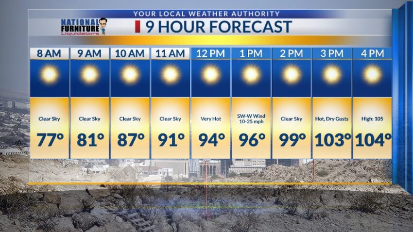
High pressure reaches its maximum this weekend. Prepare for two exceptionally hot days. Here’s your 9-Hour Forecast for Saturday:

TONIGHT: The skies will be clear, and the winds will slowly die down to a light breeze through the evening. The W-SW winds will range from 10-25 mph before they die down. The low will be 74.
FORECAST: KTSM has issued a Weather Authority Alert due to potentially dangerous high temperatures over the weekend. High pressure reaches its maximum on Sunday, but we should prepare for exceptional heat both days. Saturday will be sunny and extremely hot with a high of 105. The W-SW winds will range from 10-25 mph. Sunday will be the hottest day with a high of 107. The W-SW winds will range from 10-30 mph (no dust). Monday will be partly cloudy with a high of 102. Tuesday will be partly cloudy and cooler with a high of 96. On Tuesday afternoon, expect a chance of scattered area t-showers. Some storms may produce some brief, heavy rainfall. Wednesday will be partly cloudy and 97 with a slight chance of isolated area t-storms. Thursday will be partly cloudy and 100. If the long-range data hold together, it looks as though we’ll have another couple of days of extreme heat with a high of 105 on Friday. Saturday will be sunny and 107.

 Read: Read More