


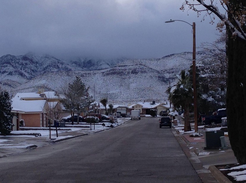
Exactly nine years ago today, El Paso was blanketed in snow. Does any city look better than El Chuco with snow on the mountains? Thanks to Weather Watch Ben Avalos for sending this beautiful picture and reminder of snow. Where’s the snow this year? Well, the mountains of New Mexico are doing well, but down here we are missing the white stuff. We have no chance over the next 9 days, but February is coming bringing great chances for winter storms.
TONIGHT: The skies will turn cloudy overnight with rain beginning near midnight. The SW winds will range from 5-15 mph and will feel chilly at times. The low will drop to 45.
FORECAST: Weather Authority Alert: KTSM has issued a Weather Authority Alert for Tuesday in anticipation of rain, which may be heavy at moments in the day. A powerful but slow-moving low-pressure system will move over the Borderland causing light to heavy rainfall on and off much of the day. The high will be 53*, and the SW winds will range from 10-20 mph. Wednesday will be partly to mostly cloudy with a continued chance of showers and light rain. Wednesday’s high will be 56, and the SW winds will range from 10-25 mph. Thursday will be partly cloudy and 59. Friday will be partly cloudy to mostly sunny with moderate winds and a high of 60. Saturday will be sunny and 62.
Read: Read More