


Our official peak gust at the airport today was 51 mph. Nearly all towns in New Mexico faced the same strong winds and blowing dust. The Borderland remains under a Blowing Dust Advisory until 7 PM. Weather Watcher Cristobal Marin sent us a video of I-10, completely shut down near mile marker 132 west of Las Cruces earlier today when visibility dropped to just a few yards!

Unfortunately, we get similar winds Wednesday afternoon as a cold front blows in. Here’s your exclusive 9-Hour Forecast.

TONIGHT: KTSM has issued a Weather Authority Alert due to strong winds and blowing dust both tonight and on Wednesday. A Blowing Dust Advisory is posted until 7 PM. The skies are hazy with dust, and the SW winds are ranging from 15 to 45 mph with the strongest gusts on the east slopes of the mountains. The winds will die down a bit in the early morning hours of Wednesday, and the low will drop to 44.
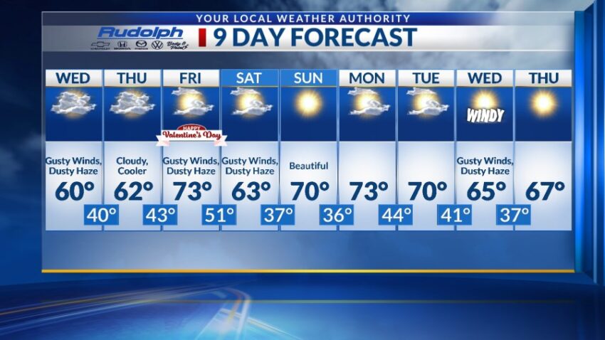
FORECAST: Wednesday will be partly to mostly cloudy and very windy with a high of 60. The W-NW winds will gust near 45 mph and will likely stir up a slight dusty haze. You’ll feel much cooler on Wednesday as temperatures drop significantly from Tuesday. Thursday will be mostly cloudy with lighter winds and a high of 62. On Valentine’s Day Friday, the morning will start out partly cloudy with light winds. By afternoon, the SW winds will be gusting to 40 mph, which will stir up a dusty haze. Friday’s high: 73. Saturday will be partly cloudy with cooler, gusty winds and a high of 63. We could see a slight dusty haze by Saturday afternoon. Sunday will be sunny and 70, an absolutely beautiful day. Monday will be partly cloudy and 73. Tuesday will be partly cloudy and 70.

Read: Read More