



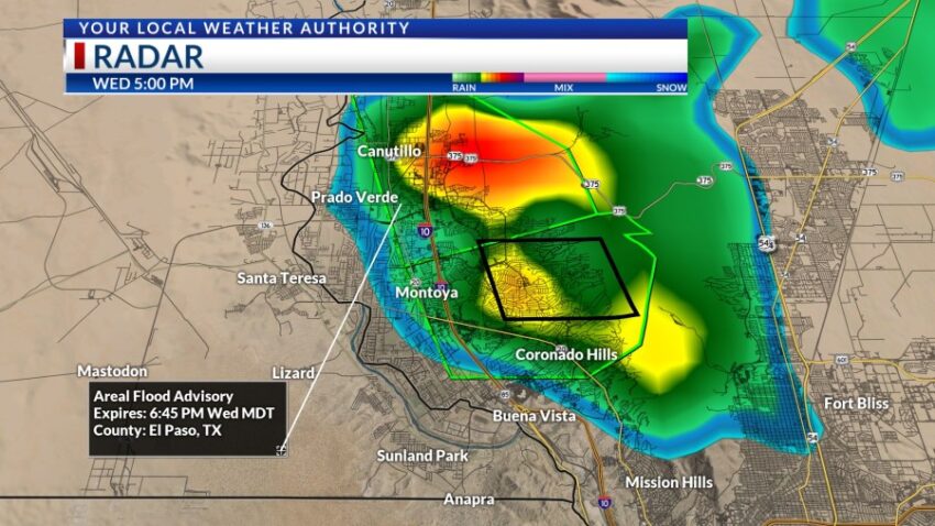
I triggered the Weather Authority Alert for this very reason: flooding on the west side. Tonight, all parts of the Borderland have the potential for heavy rainfall out of individual t-showers.

We have a similar moisture profile for Thursday, so KTSM is extending the Weather Authority Alert through Thursday night. Here’s your exclusive 9-Hour Forecast for Thursday:

TONIGHT: KTSM has issued a Weather Authority Alert due to the threat of heavy rainfall from t-showers Wednesday night and Thursday. A tremendous surge of tropical moisture is moving over the Borderland raising the possibility of heavier rainfall. Expect widely scattered showers and t-showers with mostly cloudy skies. The SE winds will range from 5-20 mph with occasional gusts as area storms break apart. The low will drop to 69.
FORECAST: Thursday will be partly cloudy and hotter with a high of 90. Though the skies will be mostly cloudy to overcast, moments of sunshine will peak through. Expect scattered t-showers with the potential for heavy rainfall out of some individual storm cells. Friday the 4th of July will be a very different day. The moisture levels thin out as we heat up for the weekend. Friday will be 98 with a chance to see some distant lightning Friday evening. Skies will be partly cloudy, and storm chances go way, way down. A giant dome of high pressure appears for Saturday. Saturday will be sunny and hot with a high of 104. Sunday will be partly cloudy and 102 with a very slight chance of distant lightning in the evening. Monday will be partly cloudy and 100 with isolated late day t-storms. Tuesday will be mostly sunny and 102. Wednesday will be sunny and 103.

Read: Read More