


With a high today of 81, we were just 2 degrees from the record of 83 set in 1904, 1986, and 2009. We can thank those westerly winds that gusted to 28 mph. Get ready, because the winds abruptly shift overnight with strong gusts and an advancing cold front. Here’s your exclusive 9-Hour Forecast for Thursday.

TONIGHT: KTSM has issued a Weather Authority Alert due to an abrupt shift in the winds, strong gusts, and a dusty haze overnight tonight. A Wind Advisory is posted from 11 PM until 8 AM. Between 11 PM and midnight, the winds will shift NE-east and gust near 40 mph. Expect stronger gusts on the west slopes. These winds are likely to stir up a dusty haze, and the low will drop to 50.
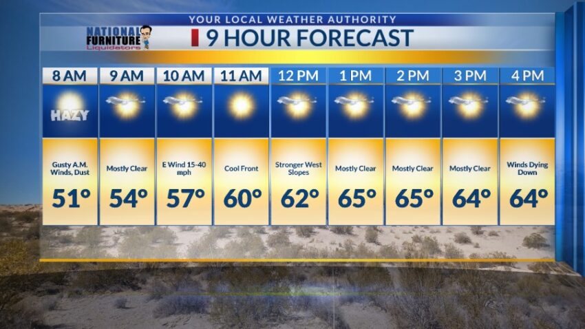
FORECAST: Thursday will be partly cloudy and cooler with a high of 65. The east winds will gust near 40 mph with the stronger gusts on the west slopes of the mountains. Expect a dusty haze, especially in the first half of the day. Winds will calm down Thursday evening. Friday will be a nearly perfect day with sunshine, light winds, and a high of 71. Saturday will be sunny and breezy with a high of 80. The SW winds will range from 5-20 mph. Sunday will be mostly sunny with moderate winds and a high of 81. The SW winds will gust to near 30 mph (no dust). Monday will be partly to mostly cloudy with strong, gusty winds and a dusty haze. Monday’s high: 78. Tuesday will be partly cloudy with strong, gusty winds and a dusty haze. Tuesday’s high: 69. Tuesday’s winds could peak at 55 mph. Wednesday will be mostly sunny with only moderate winds and no dust. Wednesday’s high: 68.

Read: Read More