


My worst fears about the threat of heavy rain materialized this morning in Northeast El Paso, where over 2 inches of rain fell within an hour, flooding roadways and damaging homes. At the airport, officially, we received 0.78 inches, bringing our total for the year to 1.35 inches for the years. (Normal is 2.14 inches so far this year.)
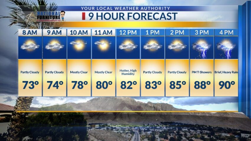
We need to be ready for quick, heavy rainfall throughout the monsoon, but let’s keep our guard up one more night as the atmosphere is extremely unstable and moist. Tomorrow, we’ll see a lot more sunshine with t-showers later in the day. Here’s your exclusive 9 Hour Forecast:

TONIGHT: KTSM has issued a Weather Authority Alert due to the potential for heavy rainfall from area t-showers. A Flash Flood Watch is posted for the entire Borderland through Wednesday night. Individual storms may unlock heavy rainfall that could quickly flood streets and arroyos. Do not drive into flooded roadways. Expect mostly cloudy skies tonight, and the low will drop to 67. The SE winds will range from 5-15 mph.
FORECAST: Thursday will be partly cloudy and hotter with a high of 90. It will feel very hot and humid midday, and the afternoon heating is likely to set off PM t-showers. Some individual storms may produce brief, heavy rain. Friday will be partly cloudy and 92 with scattered late day showers and t-showers. Saturday will be partly cloudy and 96 with scattered late day t-showers. Sunday will be 99 with isolated area t-storms. Monday will be partly to mostly cloudy with a high of 97. Expect scattered t-showers late Monday with some storms becoming quite strong. Tuesday will be partly cloudy and 96 with only a slight chance of isolated late day t-storms.

Read: Read More